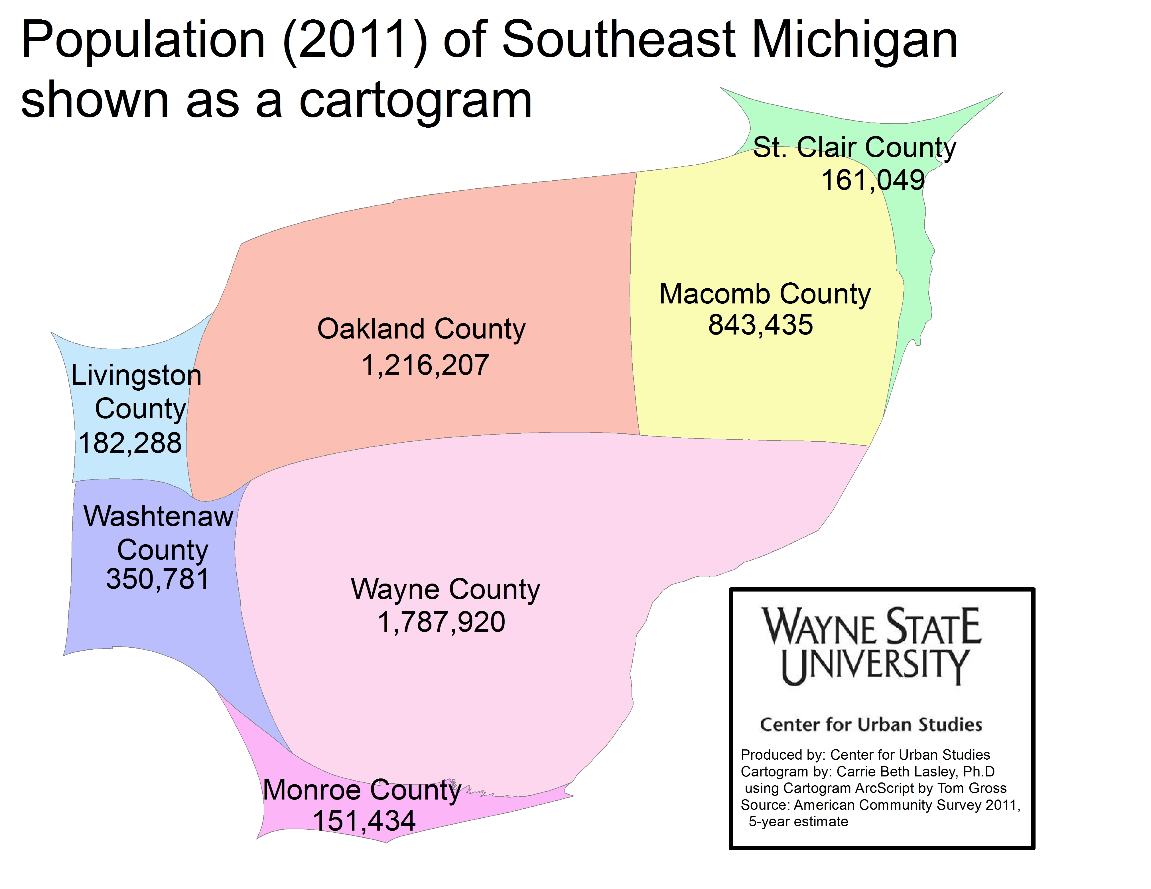
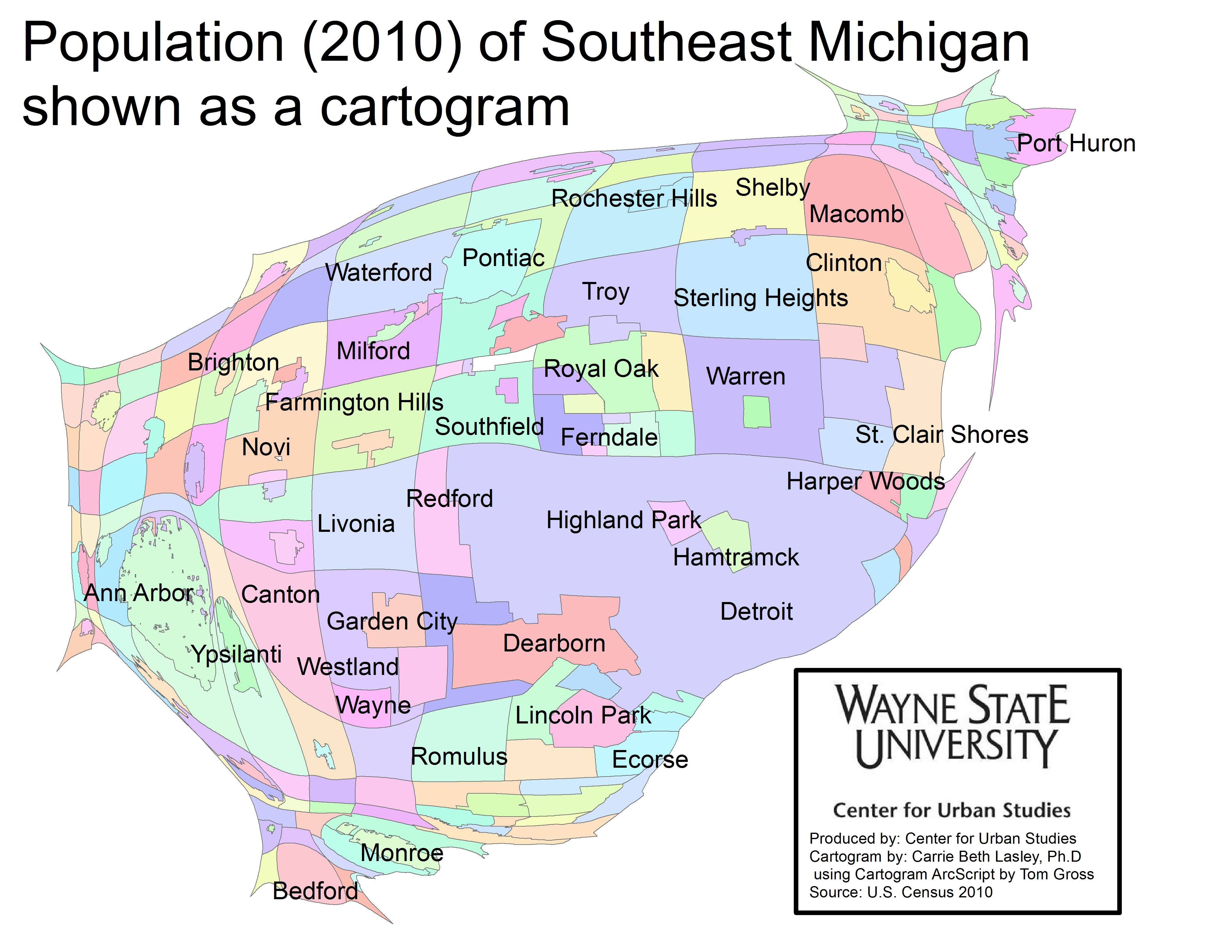
In the population cartograms below Wayne, Macomb, Oakland, Livingston, Monroe, St. Clair, and Washtenaw counties, along with the municipalities, are displayed according to their population size. A cartogram is a geographic representation method that alters the area and shape to demonstrate the relative relationship of a data feature while preserving the spatial relationship. This method allows you to visually apply weight to data, changing the way we visually experience the map, while maintaining geographic boundaries.
As can be seen, Wayne County had the highest population in 2011 of the seven counties, at about 1.8 million, and Detroit had the highest population of the all the municipalities in the region in 2010 at about 714,000.While Detroit is the most eye-catching municipality on the map because of its size, the surrounding suburbs, such as Warren, Sterling Heights, and Dearborn, also have higher populations than places in St. Clair and Washtenaw counties, with exceptions like Ann Arbor and Port Huron.
The population information was provided by the U.S. Census and the American Community Survey.